~

~
Loma Alta

Wednesday, December 23, 2015

A Strait, Some Bridges, and John Muir

November 27-29, 2015

Trails and maps used on this leg:

http://www.ridgetrail.org/vallejo-benicia-buffer

http://www.ridgetrail.org/vallejo-benicia-waterfront

http://www.ridgetrail.org/al-zampa-memorial-bridge

http://www.ridgetrail.org/benicia-martinez-bridge

http://www.ridgetrail.org/martinez-city-streets-to-carquinez-strait-regional-shoreline

http://www.ridgetrail.org/mount-wanda-trail

We started this 3-day walk as the sun set on Friday evening. With our flashlights, we charged up the ridge that connects Vallejo and Benicia, and our view over the entire early-nighttime San Francisco Bay was replete with deep, shiny purple, dark blue, and black. This is clearly a great trail, and someday we'll walk it again when the sun's up.
Mt Diablo from Hulet Hornbeck Trail, Martinez


The next morning, we began our bridge-filled day with a view of these two! In 1927, the first major bridge that crossed the San Francisco Bay was built here across the Carquinez Strait, connecting Vallejo with Crockett. In 1958, the cantilever bridge pictured below (left) was built to accommodate eastbound traffic, and it is nearly identical to the 1927 bridge. In 2003, the new suspension bridge opened, and the original 1927 span was demolished a few years later. The new bridge was named after bridge worker Al Zampa (1905-2000), who famously survived a fall while working on the Golden Gate Bridge. Here is a short interview with Zampa.

Al Zampa Memorial Bridge (right)


Benicia waterfront


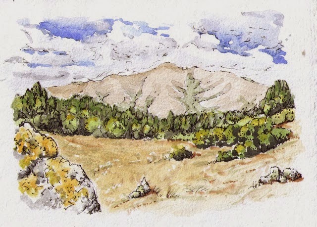
The Bay Area Ridge Trail to Martinez
Heading up Mt. Wanda early Sunday morning
We are looking forward to more walks in the East Bay this winter.
Do you want to join us?

More photos are here!

Monday, October 26, 2015

Yountville to American Canyon: Vineyards and Summits
October 17 and 18, 2015


Looking north from Rockville Hills


Trails walked on this leg:

Yountville Cross Road/Highway 29

http://www.ridgetrail.org/skyline-wilderness-park-and-napa-solano-ridge-trail

http://www.ridgetrail.org/rockville-hills-regional-park

http://www.ridgetrail.org/lynch-canyon-open-space

http://www.ridgetrail.org/hiddenbrooke-trail

We travel a ways by car to get to our trail segments for this portion of the trail. For that reason, we have been trying to hike in several parks and open spaces each trip. You can see that this leg packed a bunch of miles together!

Fall is a perfect time to walk in Napa and Solano counties. Summers can get so hot here, but now it is lovely, plus we have the added bonus of walking in the autumn slanty-light golden colors. The photo below shows the incredible lushness of botanical life that results in this deep mix of marine and volcanic soil here. San Pablo Bay once extended into this valley, and the mountains to the west are a combination of uplifted ancient sea floor and volcanic rock.

In the Napa Valley, looking west from Hwy 29

We are happy that Napa County is taking on the challenge of creating the ridge trail in their community. Getting from beautiful ridge parks to beautiful ridge open spaces requires some connectors through the urban areas sometimes, and the first trail segment of the day was south through the Napa Valley through the town of Yountville. Though the route itself is near a busy and straight highway sometimes, the views of the surrounding vineyards and rolling hills were lovely.

The kitchen garden for the restaurant, French Laundry, on the route through Yountville

We were delighted to discover Skyline Wilderness Park. We set up our camp here at noon, then spent the afternoon walking up the beautiful ridges there, partly along the eastern boundary of Napa State Hospital. This facility was established in 1875, which might coincide with this historic dump site.

Looks like a resting place for #10 tins from the Napa State hospital, maybe? This was the start of the trail in the Skyline Wilderness
Looking north to Napa Valley from Skyline Wilderness Park 


In the morning, we drove over to Fairfield and wandered through the peaceful open spaces of Rockville Hills and Lynch Canyon. I've always wanted to walk in these open rounded grassy hills that pop up just beyond the bay near Highway 80!

Looking northwest from the Rockville Hills Regional Park

Hiddenbrooke Trail in American Canyon was our last hike of the day, with the fading light of the day raking over the oaks and hills. We heard meadowlarks calling, saw hawks overhead and reveled in the views down across the bay to Mt Tam, the Golden Gate Bridge, Mt Diablo, and beyond. Looking out over the bay from the ridge above Hiddenbrooke, we can see much of our hiking history on the Ridge Trail, from Black Mountain in the South Bay to Mt. Burdell and Sonoma Mountain, and to the ridges of Calistoga and Napa Counties. What a walk we're having!

Hiking with the song of the meadowlark on Hiddenbrooke Trail
Want more photos? Please click here!

Photos of the whole trip so far: click here!

Thursday, July 2, 2015

Up and Down the Ridges of Sonoma and Napa Counties

a view in Hood Mountain Regional Park

It's been a whole year since we hiked on the Bay Area Ridge Trail! How wonderful that we are back on this marvelous trail, this time for an extended visit.

We spent five days hiking and camping along the trail in June. Since it is a fair ways from our homes in Santa Cruz, we wanted to pack in some miles. The general topography of the North Bay as it relates to the San Francisco Bay is such that the trail goes up and down north/south running ridges, which means lots of elevation gains and losses for us hikers. AND it was hot: summer temps of high 80's to 100 degrees every day on our late-June trip. 

We camped at Sugarloaf Ridge State Park and Bothe-Napa Valley State Park in between our day hikes.  On our first day out, we crossed paths with Karen Buchanan, the tour and education manager for Jack London State Historic Park, and who was on a lunchtime hike herself. In addition to providing us with lots of on-the-spot information about Jack and Charmian London, she told us about the long-term plan of hike-in campgrounds spaced all along the trail, each one a day's walk from the next. We thoroughly enjoyed the peaceful sites we had in the state parks, and the showers were just what we needed after so many miles in extremely warm temperatures.

Sugarloaf's park manager John Roney shared with us that maybe the missing links in the trail can be completed now that the demographic of the land owners is changing. Ranches are being sold to folks who buy the land to retire on or go to recreate on. Having a trail on their property now can mean that their land is connected to a much bigger piece of wild land. Ranchers tended to be reluctant to have strangers walking through. An uninterrupted trek around the Bay would be fabulous!
Here are the maps of the trails in the parks with their links:
  • 10 miles in the North Sonoma Mountain Regional Park into Jack London State Park, a newly completed section of trail in a new park near Penngrove, with Amy and Enrique joining us.


Donna starting up Sonoma Mountain

  • 10 miles in Annadel State Park, including the section not completed yet in Howarth Park near Santa Rosa, with friend Larry joining us.


an old property line in Annadel


pileated woodpecker


manzanita and oak, Annadel


view of Mt. St. Helena from Bald Mountain


top of Bald Mountain


Feather found on Oat Hill Mine Road


Spicebush, blooming abundantly in Bothe-Napa Valley State Park


a shady trail in Bothe-Napa Valley State Park


the secret swimming hole in Moore Creek on a very hot day

More photos from this fantastic five-day feast are here.