~

~
Loma Alta

Friday, July 4, 2014

Three Days in May, 2014


Blooming Buckeye!


On May 3, 4, and 5, we walked for about 35 miles through the beautiful rolling hills of Marin and Sonoma Counties.  We used the following maps:
Jack London State Historic Park

Millie, David, Adrian, Richard, Amy, and Julia joined Donna and me for all or part of Leg 11 of our round-the-bay walk.  We spent our first two nights in Fairfax with Millie, and we stayed in a hotel in Petaluma our third night.  This leg was especially social, to boot -- we played music with Donna's family one night, had dinner with Julia's aunt another night, and stopped in to visit Donna's sister-in-law as we walked through Petaluma on our third day.

But first, the turkey eggshell.  We found this as we walked up into the hills above Novato on our first morning.  Further down this page you will also see Donna's hand holding something else we found.


View of the San Francisco Bay from the ridges above Novato


Heading up towards Little Mountain Open Space Preserve


Birders on the flanks of Burdell


still ascending...


Lunchtime on Mount Burdell, elevation 1558', overlooking the Petaluma River

Mount Burdell is an anomaly in this region of ancient, sedimentary ocean floor.  The mountain is a 12-million-year-old volcanic intrusion punching through the sediment, and andesite is quarried near the summit.  Andesite is a light-grey volcanic rock named for the Andes.  Here is a link for more information about the geology of this region.


Olompali State Historic Park

The name "olompali" comes from the Miwok language and may be translated as "southern village" or "southern people." The Coast Miwok inhabited at least one site within the area of the present-day park continuously from as early as 6,000 BC, until the early 1850s. 

Olompali contains "kitchen rock," a large boulder used as a mortar in which early people ground acorns and seeds into a fine flour for food preparation. Many women would gather near such grinding rocks to prepare food and socialize. 


Worker's house at the Burdell Ranch


Camilo Ynitia [a Coast Miwok chief who received a Spanish land grant in 1843] built an adobe using in part bricks from the earlier adobe on this site constructed by his father and the Spanish exploring party of 1775-6.  Camilo’s adobe was so strongly constructed that it was incorporated in 1870 into Dr. Galen and Mrs. Mary Black Burdell’s two story home.  This ranch house was encased in 1915 by their son James Burdell with his 26 room mansion, which survived until 1969 when fire destroyed all but the walls of Ynitia’s adobe. 
You can see the 1915 house below, from a 1940 photo. 

http://heritage.sonomalibrary.org/cdm/ref/collection/p15763coll2/id/20640


Petaluma bird house


Petaluma countryside


Petaluma tick


Vineyard at Jack London's model farm


Monday, March 24, 2014

Spring Green in the North Bay

Lucas Valley Open Space Preserve
Day 11 on the trail: http://www.ridgetrail.org/index.php/loma-alta-to-lucas-valley


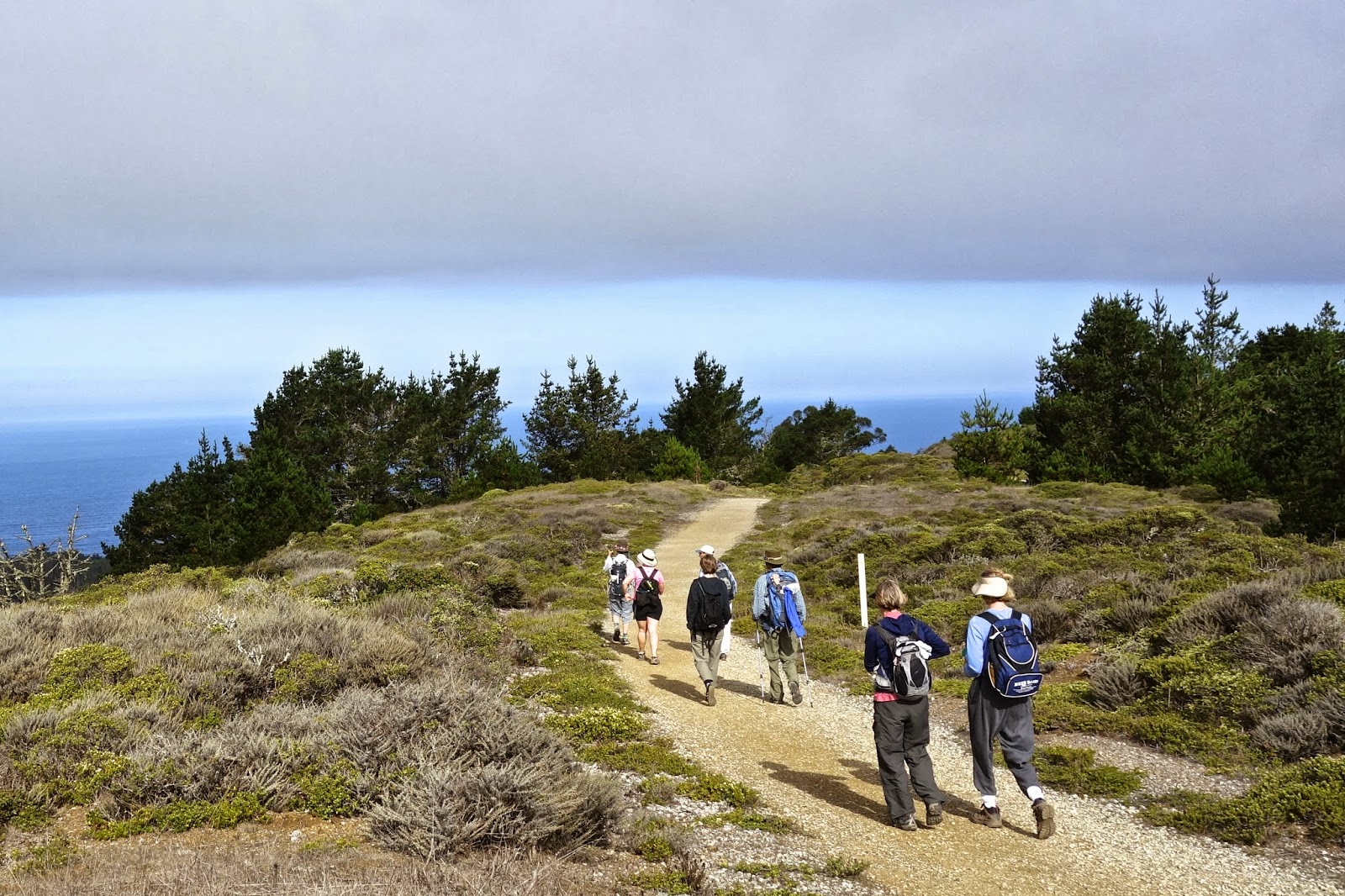
In this drought year, we've had many hikes on winter days where we could clearly see the San Francisco Bay. Our last hike on March 16 was one such day. We started at the top of White's Hill in Fairfax and immediately climbed to the top of Loma Alta, one the highest points in Marin County.  This 1592' summit descends into four distinct watersheds: Miller Creek to the northeast, Corte Madera Creek to the southeast, Lagunitas Creek to the southwest, and Nicasio Creek to the northwest.


Katharina, David, Donna and Millie on top of Loma Alta, elevation 1592'

The clouds created beautiful waving patterns through the blue and the grass was probably the greenest it will ever be this winter. 


Lucas Valley keyhole to view of Mt Diablo

The views through the velvet hills down to the bay were stunning. The uphill climbs were stunning too!  Below, we are heading up to Big Rock Ridge, elevation 1895', the second-highest point in Marin County (Mt. Tam is 2572').  Mountain lions and golden eagles are common in this quiet region of Marin.


The poppies have announced the arrival of Spring!


Lucas Valley Open Space Preserve

We ate chocolate at the top, then turned around and backtracked down the switchbacks. When the trail is finished, it will continue north to the next finished section in Indian Tree Open Space Preserve in Novato.


San Francisco Bay from Big Rock Ridge, elevation 1895'

Donna and David look out to the northeast from Big Rock Ridge
More pictures from this gorgeous day are here.

Thursday, February 6, 2014

Salmon in Papermill Creek

Shafter Grade morning
February 1, 2014

Map that inspired part of today's walk: http://www.ridgetrail.org/index.php/samuel-p-taylor-to-loma-alta

We did see salmon in the creek in Samuel P. Taylor Park. They were building their redd in the streambed under the Shafter Bridge. But that was at the end of our day!

We started our hike early Saturday morning in the cold air (32 degrees F). Steep Shafter Grade warmed us up and we were back on the Ridge Trail in the sun atop Bolinas Ridge.

Not long after we started on the ridge, a long view north revealed Tomales Bay, the water glistening between Inverness Ridge and Black Mountain. 


We passed a craggy, grey lichen-encrusted rock that David and Molly assumed correctly was graywacke.


The trail follows the ridge for 4 miles through present day grazing lands. Homesteaders planted eucalyptus and fruit trees on these dairy ranches, which are the only remnants of their time spent here.


We then dropped down to the railroad grade that runs alongside Papermill Creek in Taylor Park for the remainder of the hike. Cool and damp air surrounded us in this shady redwood and bay forest. 


We finished the day gazing at the four salmon, who by magnetoception have returned to where they hatched in this exact spot to build their redd. They looked ragged and scarred, but still vigorously swam and swished their way up the shallow rocky creek. 

Click here for more photos of our great day!


Thursday, January 23, 2014

Hiking in Donna's Hometown

Loma Alta from Camp Tamarancho, Fairfax

Day 9 on the trail: Shafter bridge at the Inkwells to near White's Hill in Fairfax

Parts of maps used on this leg:

http://www.ridgetrail.org/index.php/samuel-p-taylor-to-loma-alta

http://www.ridgetrail.org/index.php/loma-alta-to-lucas-valley

We hiked in the territory of Donna's youth. She rambled over these trails while growing up in the hills of Fairfax, falling in love with hiking, viewing and tree-climbing!

We were joined by lots of Donna's family, as they were excited to hike on trails not often traveled, even though they are in their backyards.


We got on the Ridge Trail up the hill from Shafter Bridge, and hiked in the fog through the open grasslands.

By the time we got up a bit higher, we saw the junipers and scrubby manzanita and rocky-lichen terrain of the ridge by White's Hill.


The finish was off the Ridge Trail proper, as we wanted to end up in the home of Donna's mom, where Donna grew up, which is just down the trail from the Boy Scout's "Camp Tamarancho."


Sunday, November 10, 2013

Days 7 and 8: Mt. Tamalpais


November 2-3, 2013

Stinson Beach and Bolinas from Bolinas Ridge

Maps used on this 2-day leg are:

http://www.ridgetrail.org/index.php/golden-gate-bridge-to-tennessee-valley

http://www.ridgetrail.org/index.php/tennessee-valley-to-shoreline-highway

http://www.ridgetrail.org/index.php/dias-ridge

http://www.ridgetrail.org/index.php/mount-tamalpais-state-park

http://www.ridgetrail.org/index.php/mount-tamalpais-state-park-and-ggnra

http://www.ridgetrail.org/index.php/ggnra-and-samuel-p-taylor-state-park

We were joined by our cheerful and indefatigable walking friend David again, this time for a 30-mile overnighter.  Donna and I left a car in the Presidio at her friend Mary's house.  Mary drove us to the north end of the Golden Gate Bridge, where we met David, who'd walked there from his house.  Our first day out was approximately 15 miles long; David's was over 20.

Here is the north end of the bridge at about 9:00 Saturday morning.


An hour later or so, we had our first view of Mt. Tam.  The mountain's elevation is 2575' currently; it used to be over 2600' tall before the summit was graded for the installation of radar equipment.

We will spend tonight near the summit at the Pan Toll campground.  There are walk-in sites -- no reservation necessary!  We found a great site, visited with a camping chef who is getting ready to open an unusual Thai restaurant in downtown San Francisco, and we cooked our morning oatmeal on Sunday over a fire due to a balky backpacking stove.


Day 2: Mt. Tam and the Bolinas Ridge (below) are bits of the North American Plate which have been pushed up as the plate slides over and along the Pacific Plate.  More evidence of this plate-to-plate interaction is the preponderance along the trail of green-black serpentinite, which is formed underwater at the interface.  Serpentine is our state rock.

We will now be firmly on the North American Plate for the rest of our round-the-bay walk.  


Mt. Tam State Park 


Sunday afternoon: Lagunitas Creek. and the end of our beautiful 2-day trek.  You can find more photos and information about this leg here.


Wednesday, October 9, 2013

Day 6: San Francisco, the Beautiful City

Painted from the Bay Area Ridge Trail in the Presidio, San Francisco

Saturday, October 5, 2013

Today we walk clear across San Francisco, from the southwest to Sausalito.  The official maps we are using are:

http://www.ridgetrail.org/index.php/fort-funston-to-stern-grove

http://www.ridgetrail.org/index.php/stern-grove-to-the-presidio

http://www.ridgetrail.org/index.php/san-francisco-presidio

http://www.ridgetrail.org/index.php/golden-gate-bridge


However, we have charted our own course today thanks to our San Franciscan friend David, who walks these streets all the time, and really knows his way around.  What's more, Ft. Funston was closed due to the shutdown of the federal government, so we started slightly north of there, on Brotherhood Way, and walked across the Lake Merced neighborhood.

Our route, in a nutshell, was: Brotherhood Way, Merced Heights, Joost St., Glen Canyon, Twin Peaks, Mt. Sutro, Golden Gate Park, the Presidio, and the Golden Gate Bridge.  It was a perfect walk for a perfectly sunny day.

Our crew today includes friends Suzanne, Julia, David, and Jonathan (for a bit at the beginning).

We are looking at the view, visible in the photo below.  We have just walked up the hill from Brotherhood Way and Temple Beth Israel-Judea to Merced Heights.


Walking along Joost Street, named after Behrend Joost.  You can read about him here.


Scaling Mt. Sutro


Finishing up a terrific 15-mile walk.  Thanks, David, for the excellent route.

More photos from the day here.

Friday, September 20, 2013

Day 5: We amble beside the Pacific Ocean

Pacific Ocean near Ft. Funston


Sunday, September 16, 2013

Maps used creatively today: 

Sweeney Ridge to Milagra Ridge

Mussel Rock to Fort Funston


Eight of us today -- our biggest group yet!  Donna and I walked to San Francisco today with Julia, Amy, Sandra, Katarina (visiting from Germany), David, and Peter.  As we descended Sweeney Ridge at around 10 in the morning, the fog began to clear.


This is the view of Pacifica and the Pacific from Milagra Ridge.


Here is Mussel Rock, a remnant of the Farallon Plate, which now lies mostly underneath the North American Plate.  The ancient seafloor that makes up Mussel Rock is much older and much more erosionally resistant than the 3-million-year-old sedimentary Merced Formation on the coast.

The epicenter of the 1906 San Francisco earthquake is about 2 miles offshore to the north of Mussel Rock.


This landslide above Mussel Rock was triggered by the 1906 earthquake.  The houses are more recent.


After much debate and careful consideration, Donna goes for it.  Fort Funston is two miles away up the beach.  As long as it's low tide and there's no catastrophic earthquake, this option is probably safe enough.  All eight of us made it.


More photos from today here!